![]()
|
|
| Sure hope the city preps for what's coming (1368431) | |||
|
|
|||
| Home > SubChat | |||
|
[ Read Responses | Post a New Response | Return to the Index ] |
|
||
Sure hope the city preps for what's coming |
|
|
Posted by SelkirkTMO on Thu Oct 1 01:55:50 2015 When hurricanes fire up after what we've been through upstate, first thing I do is head for the GFS meteorological models. The upcoming current conditions mean that the city (and it's underground) may end up getting severely flooded even IF the hurricane diverts out to see before showing up. If it still maintains its course, it could be very unhappy indeed.This is the current jetstream and upper level conditions, which almost guarantees water is going to be heavy up here since all of the weather has to go around the bottom as shown here: 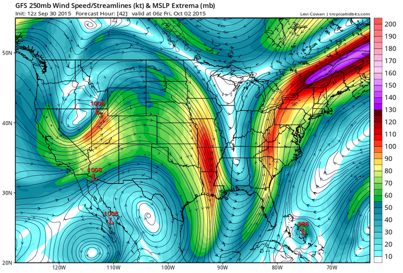 ADD to the fun that there's a hurricane out there brewing, and the above maps do not include it so far. Here is the epected rainfall amounts predicted by the GFS model, not including the hurricane's epected trajectory: 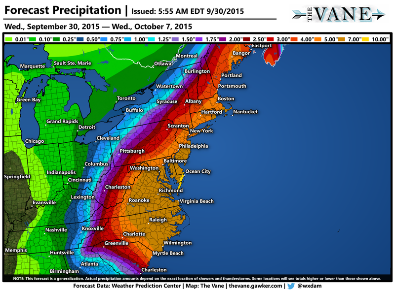 And finally, here's the epected path, but hurricanes have a nasty habit of changing direction and intensity at the last moment. 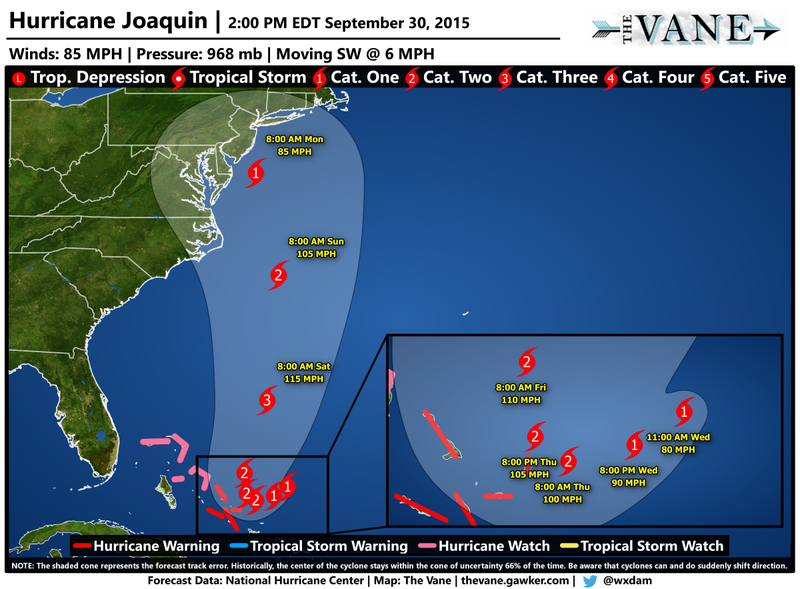 Be safe, everyone ... plan ahead! |