![]()
|
|
| 30 years ago - 1972 Vignelli NYC subway map release (1171444) | |
|
|
|
| Home > SubChat | |
[ Post a New Response | Return to the Index ]
| (1171444) | |
30 years ago - 1972 Vignelli NYC subway map release |
|
|
Posted by Gold_12TH on Thu Aug 9 14:23:46 2012  |
|
| (1171446) | |
40 years ago - 1972 Vignelli NYC subway map release |
|
|
Posted by Newkirk Plaza David on Thu Aug 9 14:35:21 2012, in response to 30 years ago - 1972 Vignelli NYC subway map release, posted by Gold_12TH on Thu Aug 9 14:23:46 2012. Subject line corrected.Despite the two geographical errors - - it's still an impressive map. |
|
| (1171447) | |
Re: 40 years ago - 1972 Vignelli NYC subway map release |
|
|
Posted by Gold_12TH on Thu Aug 9 14:35:56 2012, in response to 40 years ago - 1972 Vignelli NYC subway map release, posted by Newkirk Plaza David on Thu Aug 9 14:35:21 2012. my math is awful :) stupid keyboard. |
|
| (Sponsored) |
iPhone 6 (4.7 Inch) Premium PU Leather Wallet Case - Red w/ Floral Interior - by Notch-It |
| (1171448) | |
Re: 40 years ago - 1972 Vignelli NYC subway map release |
|
|
Posted by Joe Saitta on Thu Aug 9 14:37:47 2012, in response to 40 years ago - 1972 Vignelli NYC subway map release, posted by Newkirk Plaza David on Thu Aug 9 14:35:21 2012. Very hard to find one. However, on eBay, item #320959057871 there is a brand new 1974 edition Vignelli map. |
|
| (1171450) | |
Re: 30 years ago - 1972 Vignelli NYC subway map release |
|
|
Posted by New Flyer #857 on Thu Aug 9 14:44:54 2012, in response to 30 years ago - 1972 Vignelli NYC subway map release, posted by Gold_12TH on Thu Aug 9 14:23:46 2012. My family has accumulated quite a number of old maps like these, simply by saving them over the years. But I'm a buyer, not a seller. So they can be a last resort if I run out of money!So I see the QJ / KK skip-stop was setup then. Did skip-stop get used all the way up until when the Z was born? Does anyone know any other configurations that were used? Also, can anyone comment on the A line? The description of the line on the map is vague from a railfan point of view. Exactly how much through service to the Rockaways was there? Was it mainly that most or all of the A trains went to Lefferts when the E was running? Did the A or E ever use the single track connecting B 67 and B 90 on a regular basis? What were nights like? Thanks in advance! |
|
| (1171451) | |
Re: 30 years ago - 1972 Vignelli NYC subway map release |
|
|
Posted by mike cruz on Thu Aug 9 14:49:51 2012, in response to 30 years ago - 1972 Vignelli NYC subway map release, posted by Gold_12TH on Thu Aug 9 14:23:46 2012. Back in tha day boy! It's too bad some of the service patterns aren't still around it would probly be beneficial. |
|
| (1171453) | |
Re: 30 years ago - 1972 Vignelli NYC subway map release |
|
|
Posted by LRG5784 on Thu Aug 9 15:01:13 2012, in response to Re: 30 years ago - 1972 Vignelli NYC subway map release, posted by New Flyer #857 on Thu Aug 9 14:44:54 2012. Skip-stop was resurrected again in 1988 when the Archer Avenue Line opened. It was discontinued in 1976 when the (K) was cut. |
|
| (1171455) | |
Re: 30 years ago - 1972 Vignelli NYC subway map release |
|
|
Posted by Michael549 on Thu Aug 9 15:10:24 2012, in response to Re: 30 years ago - 1972 Vignelli NYC subway map release, posted by LRG5784 on Thu Aug 9 15:01:13 2012. I thought for a time after the 168th Street-Jamaica version KK Or K was eliminated or shortened, the J-trains made skip-stop runs, with "A" J-trains, and "B" J-trains. I seem to remember subway maps of the 1970's or early 1980's saying so.Mike |
|
| (1171456) | |
Re: 30 years ago - 1972 Vignelli NYC subway map release |
|
|
Posted by LA Scott on Thu Aug 9 15:22:45 2012, in response to 30 years ago - 1972 Vignelli NYC subway map release, posted by Gold_12TH on Thu Aug 9 14:23:46 2012. I've always disliked that map. Way too many thick lines, and the attempt to have a separate color for each line fails in a few places where different lines of similar colors cross.For instance, it looks like B branches onto the 5 north of Atlantic/Pacific. |
|
| (1171491) | |
Re: 30 years ago - 1972 Vignelli NYC subway map release |
|
|
Posted by renee gil on Thu Aug 9 16:45:16 2012, in response to Re: 30 years ago - 1972 Vignelli NYC subway map release, posted by LA Scott on Thu Aug 9 15:22:45 2012. The specific problem has to do with New York's grid system, which made the 1972 map's inaccuracies too glaring. In London, the non-orthogonal street grid makes the mental relationship between the Kennington Station and the Vauxhall Station (as noted above) vague and flexible. Twenty-five years later in New York, according to the New York Times, people still remember that "to preserve its aesthetics, [the 1972] map put the 50th Street stop on the 7th Ave-Broadway line west of Eighth Avenue, far from where it belonged." |
|
| (1171493) | |
Re: 40 years ago - 1972 Vignelli NYC subway map release |
|
|
Posted by mcorivervsaf on Thu Aug 9 17:06:32 2012, in response to 30 years ago - 1972 Vignelli NYC subway map release, posted by Gold_12TH on Thu Aug 9 14:23:46 2012. Hard to believe it's been that long! I wasn't too big of a fan of this map; everything just looks out of proportion. I prefer the 1979 redesign, which was a vast improvement! I still have a copy of that in my archives! |
|
| (1171495) | |
Re: 40 years ago - 1972 Vignelli NYC subway map release |
|
|
Posted by renee gil on Thu Aug 9 17:14:36 2012, in response to Re: 40 years ago - 1972 Vignelli NYC subway map release, posted by mcorivervsaf on Thu Aug 9 17:06:32 2012. 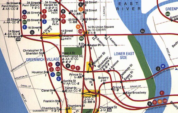 This is a prototype of the 1979 map featured trunk lines that were all red with multi-colored bullets designating train routing. |
|
| (1171496) | |
Re: 40 years ago - 1972 Vignelli NYC subway map release |
|
|
Posted by mcorivervsaf on Thu Aug 9 17:36:52 2012, in response to Re: 40 years ago - 1972 Vignelli NYC subway map release, posted by renee gil on Thu Aug 9 17:14:36 2012. Hmm... Not bad! Too bad the colors were changed! |
|
| (1171499) | |
Re: 30 years ago - 1972 Vignelli NYC subway map release |
|
|
Posted by Chris R16/R2730 on Thu Aug 9 18:31:03 2012, in response to 30 years ago - 1972 Vignelli NYC subway map release, posted by Gold_12TH on Thu Aug 9 14:23:46 2012. Neat. Got a real one off e-Bay about 12 years ago. My favorite map. Wife won't let me hang it, though. |
|
| (1171500) | |
Re: 30 years ago - 1972 Vignelli NYC subway map release |
|
|
Posted by Dupont Circle Station on Thu Aug 9 18:42:08 2012, in response to Re: 30 years ago - 1972 Vignelli NYC subway map release, posted by LRG5784 on Thu Aug 9 15:01:13 2012. Correct. The "Z" was introduced to take the A/B confusion out of the mix. Much easier for people to know they need to be on a J or a Z for their stop. |
|
| (1171503) | |
Re: 30 years ago - 1972 Vignelli NYC subway map release |
|
|
Posted by LA Scott on Thu Aug 9 18:57:33 2012, in response to Re: 30 years ago - 1972 Vignelli NYC subway map release, posted by renee gil on Thu Aug 9 16:45:16 2012. I know the geographic issues are what most people focus on, but even ignoring that, I don't like the design.With the London map, the lines seem more narrow, and you don't have lots or places where 4 or more lines run together. In fact, there are not many places where 3 lines run together. With so much space taken up by the thick lines on the Vignelli map, I feel the station names get lost. On the tube map, I can't think of any place where the space taken by the lines is anywhere close to the width of the station name. The Vignelli map is covered with those situations. |
|
| (1171507) | |
Re: 40 years ago - 1972 Vignelli NYC subway map release |
|
|
Posted by Kevin from Midwood on Thu Aug 9 19:07:18 2012, in response to 30 years ago - 1972 Vignelli NYC subway map release, posted by Gold_12TH on Thu Aug 9 14:23:46 2012. Thanks for posting this.> Click the image to see it bigger... (PDF format - Size: 27 MB) I had to create a Microsoft account to do so. Is it possible to share to public on SkyDrive without requiring sign-ins? I know Dropbox users can. |
|
| (1171566) | |
Re: 40 years ago - 1972 Vignelli NYC subway map release |
|
|
Posted by Sand Box John on Thu Aug 9 23:27:25 2012, in response to Re: 40 years ago - 1972 Vignelli NYC subway map release, posted by Kevin from Midwood on Thu Aug 9 19:07:18 2012. I had to create a Microsoft account to do so. Is it possible to share to public on SkyDrive without requiring sign-ins? I know Dropbox users can.In Firefox do a Save Page As > Save as type: Web Page, complete. "1972_System_Map - SkyDrive.htm". Firefox will save the source HTML and create the directoy "1972_System_Map - SkyDrive_files" the "1972_System_Map.pdf" file will be in that directory. Using Internet Explorer doing the same will not save the PDF file in the "files" directory. John in the sand box of Maryland's eastern shore. |
|
| (1171597) | |
Re: 40 years ago - 1972 Vignelli NYC subway map release |
|
|
Posted by Terrapin Station on Fri Aug 10 12:51:56 2012, in response to Re: 40 years ago - 1972 Vignelli NYC subway map release, posted by Joe Saitta on Thu Aug 9 14:37:47 2012. Very hard to find one. However, on eBay, item #320959057871 there is a brand new 1974 edition Vignelli map. Re: Spring cleaning auction on ebay (1148405) |
|
| (1171603) | |
Re: 40 years ago - 1972 Vignelli NYC subway map release |
|
|
Posted by Gamera on Fri Aug 10 13:12:11 2012, in response to Re: 40 years ago - 1972 Vignelli NYC subway map release, posted by Terrapin Station on Fri Aug 10 12:51:56 2012. hope he sues you for that |
|
| (1171605) | |
Re: 40 years ago - 1972 Vignelli NYC subway map release |
|
|
Posted by Railman718 on Fri Aug 10 13:15:13 2012, in response to Re: 40 years ago - 1972 Vignelli NYC subway map release, posted by Gamera on Fri Aug 10 13:12:11 2012. Loser boy is just Livid because he got punked a few days ago in BusChat..Wifey must have been busy with the Kids for him to use the home computer.. |
|
| (1171619) | |
Re: 30 years ago - 1972 Vignelli NYC subway map release |
|
|
Posted by MainR3664 on Fri Aug 10 14:36:46 2012, in response to 30 years ago - 1972 Vignelli NYC subway map release, posted by Gold_12TH on Thu Aug 9 14:23:46 2012. Neat. It showed the #8- 3rd Ave local, which at that point, had less than 1 year to live. Which is sad...It's nice to see this map revised, in the modern color scheme, for the MTA's "Weekender"...and that there soem routes that didn't exiast in 1972...it hasn't all been detruction. |
|
| (1171622) | |
Re: 30 years ago - 1972 Vignelli NYC subway map release |
|
|
Posted by MainR3664 on Fri Aug 10 14:39:43 2012, in response to Re: 30 years ago - 1972 Vignelli NYC subway map release, posted by LRG5784 on Thu Aug 9 15:01:13 2012. I disagree. I believe that skip-stop lasted until 1985, when the line was shortened to 11th, and then 121st Street. It even existed in the late 1977-early 1985 period when the J ran to Queens Boulevard.And, as we all agree, it came back in '88... |
|
| (1171625) | |
Re: 40 years ago - 1972 Vignelli NYC subway map release |
|
|
Posted by MainR3664 on Fri Aug 10 14:42:55 2012, in response to Re: 40 years ago - 1972 Vignelli NYC subway map release, posted by renee gil on Thu Aug 9 17:14:36 2012. Wow...I didn't know of THIS version, which attempted to preserve to individual line colors.I actually have a first edition 1979 map, showing trunk colors only. I obtained it from a station agent, at the time...1 owner (me) only1!! |
|
| (1171657) | |
Re: 40 years ago - 1972 Vignelli NYC subway map release |
|
|
Posted by Kevin from Midwood on Fri Aug 10 16:33:43 2012, in response to Re: 40 years ago - 1972 Vignelli NYC subway map release, posted by Sand Box John on Thu Aug 9 23:27:25 2012. Thanks. In this case it seems SkyDrive doesn't play well with Chrome and Safari. Instead of displaying the contents of the PDF right on the page as it does in FF and IE, the panel stays gray, which is a little confusing. |
|
| (1171692) | |
Re: 40 years ago - 1972 Vignelli NYC subway map release |
|
|
Posted by Dan Lawrence on Fri Aug 10 19:52:07 2012, in response to Re: 40 years ago - 1972 Vignelli NYC subway map release, posted by Railman718 on Fri Aug 10 13:15:13 2012. I suspect he goes by the rule that the women run the house and kids. |
|
| (1171934) | |
Re: 30 years ago - 1972 Vignelli NYC subway map release |
|
|
Posted by Steve B-8AVEXP on Sun Aug 12 18:36:51 2012, in response to 30 years ago - 1972 Vignelli NYC subway map release, posted by Gold_12TH on Thu Aug 9 14:23:46 2012. My father picked up a copy of that map when it came out and gave it to me. I still have it, too. |
|
| (1173028) | |
Re: 30 years ago - 1972 Vignelli NYC subway map release |
|
|
Posted by Chris R16/R2730 on Fri Aug 17 15:46:12 2012, in response to 30 years ago - 1972 Vignelli NYC subway map release, posted by Gold_12TH on Thu Aug 9 14:23:46 2012. Ladies, just say yes to the Vignelli dress:
|
|
| (1173089) | |
Re: 30 years ago - 1972 Vignelli NYC subway map release |
|
|
Posted by Kevin from Midwood on Fri Aug 17 19:18:04 2012, in response to Re: 30 years ago - 1972 Vignelli NYC subway map release, posted by Chris R16/R2730 on Fri Aug 17 15:46:12 2012. An unspoken word hangs in the air. |
|
| (1173203) | |
Re: 30 years ago - 1972 Vignelli NYC subway map release |
|
|
Posted by Chris R16/R2730 on Sat Aug 18 14:32:45 2012, in response to Re: 30 years ago - 1972 Vignelli NYC subway map release, posted by Kevin from Midwood on Fri Aug 17 19:18:04 2012. I bet that model was Korean. |
|
| (1317291) | |
Re: 30 years ago - 1972 Vignelli NYC subway map release |
|
|
Posted by INDviaCulver on Tue Oct 7 03:53:03 2014, in response to Re: 30 years ago - 1972 Vignelli NYC subway map release, posted by New Flyer #857 on Thu Aug 9 14:44:54 2012. KK/QJ Skip Stop service ran to Manhattan AM peak only. J trains continued that pattern until April 1985. A trains went to Euclid or Lefferts at all times, and to Far Rockaway non-rush hrs. Shuttle trains ran to Rockaway Park non-rush hrs as well. During the rush-hrs, E via Fulton Express trains ran to Euclid, Far Rockaway, OR Rockaway Park. There were a couple of E trains put in at Lefferts before the AM peak. |
|
| (1317292) | |
Re: 30 years ago - 1972 Vignelli NYC subway map release |
|
|
Posted by Nilet on Tue Oct 7 04:06:19 2014, in response to Re: 30 years ago - 1972 Vignelli NYC subway map release, posted by Michael549 on Thu Aug 9 15:10:24 2012. My 1979 map lists A/B skip-stop service.A Stops: Gates Avenue Chauncey Street Van Siclen Avenue Norwood Avenue Cypress Hills Woodhaven Boulevard 111th Street Metropolitan Avenue B Stops: Kosciusko Street Halsey Street Alabama Avenue Cleveland Street Crescent Street Forest Parkway 102nd Street 121st Street AB Stops: Myrtle Avenue Eastern Parkway Elderts Lane Queens Boulevard Sutphin Boulevard, 160th Street and 168th Street already closed and demolished. |
|
| (1317347) | |
Re: 30 years ago - 1972 Vignelli NYC subway map release |
|
|
Posted by Larry,RedbirdR33 on Tue Oct 7 10:07:11 2014, in response to Re: 30 years ago - 1972 Vignelli NYC subway map release, posted by New Flyer #857 on Thu Aug 9 14:44:54 2012. So I see the QJ / KK skip-stop was setup then. Did skip-stop get used all the way up until when the Z was born? Does anyone know any other configurations that were used?Nilet: This might answer some of your questions. Tuscarora Dispatch No 2 JAMAICA LINE SKIP-STOP SERVICE 1959 to 1980 Skip - Stop service on the BMT Jamaica Avenue Line began in June of 1959. The basic setup was that Manhattan - bound trains leaving from 168 Street - Jamaica Avenue on weekdays from about 7 AM to 8:30 AM would make limited stops from there to Eastern Parkway. Stations along the route would be identified by "A" or "B" signs . No.14 Broadway - Brooklyn Local trains would stop at the "B" stations while No.15 Jamaica Express trains stop at the "A" stations. Four stations; 168 Street, Sutphin Boulevard, Elderts Lane and Eastern Parkway were served by both routes and displayed both "A" and "B" signs. No.14 Locals would stop at 168 St, 160 St, Sutphin Blvd, Queens Blvd, Metropolitan Av, 102 Street, Elderts Ln, Cypress Hills, Norwood Av, Van Siclen Av, Alabama Av and Eastern Parkway. They would then make all local stops to Canal Street. No.15 Expresses would stop at 168 St, Sutphin Blvd, 121 St, 111 St, Woodhaven Blvd, Forest Pkwy, Elderts Ln, Crescent St, Cleveland St, and Eastern Parkway. They would then run express along Broadway stopping at Myrtle Avenue and Essex Street and making all stops to Broad Street. Skip-stop service was offered Manhattan-bound in the AM rush only. This service pattern continued until November 26, 1967 when the Chrystie Street - Manhattan Bridge Line opened. "QJ" trains would replace the No.15 Express and "JJ" trains would replace the No.14 Locals. The service pattern was otherwise unchanged with "QJ" trains stopping at the "A" stations and "JJ" trains stopping at the "B" stations. There was still no PM skip-stop service. The Chrystie Street - Williamsburg Bridge Line opened on July 1, 1968 and a new service, the "KK" replaced the "JJ" . It would operate between 57 Street - 6 Avenue and 168 Street - Jamaica in both directions during the rush hours. About this time the "A" and "B" signs at the stations were replaced by "QJ" and "KK" signs with all - stop stations carrying both signs. Skip-stop service would now operate Manhattan-bound in the AM rush and Queens-bound in the PM rush. "KK" trains in skip-stop service would make all "KK" or "B" stops between 168 Street and Eastern Parkway and then make all local stops between that point and 57 Street and 6 Avenue. Service changes were announced for September 10, 1972 but where postponed until the weekend of December 31, 1972 - January 1, 1973. The "QJ" would be replaced by a new service called the "J' which would run between 168 Street and Broad Street at all times. The "KK" would be replaced by the "K" which would operate between 57 Street - 6 Avenue and Eastern Parkway during rush hours. Hereafter all service on the Jamaica Avenue Line would be provided by "J" trains. Skip-stop service would continue with alternate "J" trains serving "A" or "B" stops .(See original list) Skip-stop service in the PM rush was discontinued and the time of the AM operation were shortened to about 50 minutes. It is unclear how passengers were supposed to differentiate between the "A" or "B" trains. The roll signs were never changed and the subway maps issued from 1972 (2) through 1978 while they mentioned the service did not list which trains made which stops. The 6 Avenue "K" was discontinued on August 27, 1976 and skip-stop service was extended westward to Myrtle Avenue. Chauncey St and Gates Avenue would become "A" stops while Halsey St and Kosciusko St would become "B" stops. The Diamond Jubilee Edition of the New York City Subway Map was a marked improvement over its predecessors. Issued in June of 1979 it was the first map since 1969 to list the "A" and "B" stations on both the front and reverse. All "J" Line skip-stop service was discontinued on December 1, 1980. Skip-stop service would return to the Jamaica and Broadway-Brooklyn Lines in December 1988 with the opening of the Archer Avenue Line Note to Map Collectors: In addition to the 1979 Map the Fall 1980 map listed the "A" and "B" stations as well, but which one? It seems that two maps were issued with the copyright @1979 New York City Transit Authority, Revised Fall 1980. The first map has a side fold and strip maps for the 6 Avenue Line services under the title. The second map has a vertical fold and strips maps for the Lexington Avenue Line under the title. Only the first map shows the "A" and "B" stations on the "J" Line. The second map was issued right after the skip-stop service was discontinued. Larry, RedbirdR33 |
|
| (1317388) | |
Re: 30 years ago - 1972 Vignelli NYC subway map release |
|
|
Posted by Dyre Dan on Tue Oct 7 12:39:40 2014, in response to Re: 30 years ago - 1972 Vignelli NYC subway map release, posted by Larry,RedbirdR33 on Tue Oct 7 10:07:11 2014. A very nice history. I am a little surprised that the original version of skip-stop service used trains that were express on Broadway and trains that were local on Broadway as its two services. That would not seem to make for balanced loading, which seems to be one of the goals of the current J/Z skip-stop service. I'm wondering if a lot of people from "B" stations get off the No. 14 local at Eastern Parkway to change for the No. 15 express. |
|
